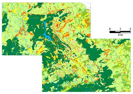
Data sources: Aerial photographs (Nov. 1998), SPOT Panchromatic
(23/12/98) and
Landsat 7 EMT (29 Dec. 1999).
Data processing, image interpretation, and map preparation:
VTGEO as sub-contractor to PARC project VIE/95/G31
Legend Harmonization: SAM-Regional and VTGEO